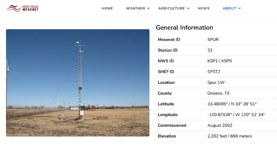
West Texas Mesonet is a network that includes over 160 weather stations approximately 25 miles apart across 90 Texas counties, as well as a few stations in New Mexico and Colorado. How is this weather data gathered, and how is it used?
These weather stations measure wind speed, direction and temperature, solar radiation, relative humidity and dewpoint, barometric pressure and precipitation, soil temperatures and moisture and leaf moisture. The project was designed to aid agricultural interests after Lubbock’s Reese Air Force Base was closed. Funding was provided in 1999 by the Texas Department of Economic Development through the Texas Tech University Wind Science and Engineering Center, which is now the National Wind Institute. The first station was completed in 2000, and a series of 30 stations were bult in nine counties in partnership with private ranches.
Landowners and many volunteers have helped to provide this community service, and the project has continued and expand significantly since then. Now there are stations in Amarillo, Aspermont, Clarendon, Floydada, Guthrie, Haskell, Jayton, Knox City, Lubbock, Matador, McAdoo, Paducah, Post, Quitaque, Roaring Springs, Silverton, Spur, Turkey and many more locations throughout the region.
Operations manager Wes Burgett said that these stations are a useful major investment, costing approximately $25,000 each. Burgett manages a very small group of employees and works with volunteers who collect samples and provide weather information on 29 different parameters that is then used for research and distributed through a free app and website. Visitors can go to www.mesonet. ttu.edu for weather and agricultural information, such as weather forecasts and a daily soil summary.
“We just finished our 167th station on the KC Ranch in the Davis Mountains on March 28,” Burgett said, explaining that the next station on the list to go live will be on the Angelo State University campus in San Angelo.
“Farmers can use the app in the field in real time because it is easy to see it well on a phone and you can choose which stations you want to see. We also send the information to the National Weather Service, which can be used to determine weather warnings for public safety.”
Thoughthewebpageprovides daily and monthly summaries and that are free toview,anarchivewithmore detailed historic data is also kept through a third party called Synoptic Data. A fee may be required for a business to access historic data for commercial purposes.